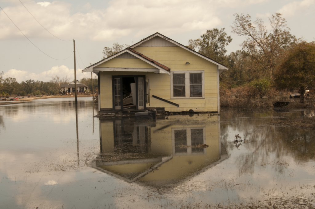
Two years after Hurricane Maria tore through Puerto Rico, Karla Reyes Ríos still kept her children’s backpacks packed just in case. When Maria’s 155 mph winds stripped roofs from homes and floods swallowed entire neighborhoods, Karla lost nearly everything except her family. Even long after the skies cleared, the storm lingered through months of displacement, rebuilding, and a constant readiness for the next one.
Today, that next one could be Tropical Storm Erin.
Formed in the eastern Atlantic, Erin is the fifth named storm of the 2025 hurricane season. As of Tuesday, it was located about 280 miles west-northwest of the Cabo Verde Islands, moving steadily west at 20–22 mph with sustained winds near 45 mph. Forecast models suggest Erin could become the season’s first hurricane by midweek and potentially reach major hurricane strength (Category 3 or higher) by the weekend.
For now, the risk of direct impact on the U.S. East Coast is low. But for parts of the Caribbean, including Puerto Rico, the Leeward Islands, and Bermuda, Erin’s track is worth watching closely. The storm’s precursor system already caused deadly flooding in the Cabo Verde Islands.
The Drawbacks and Risks
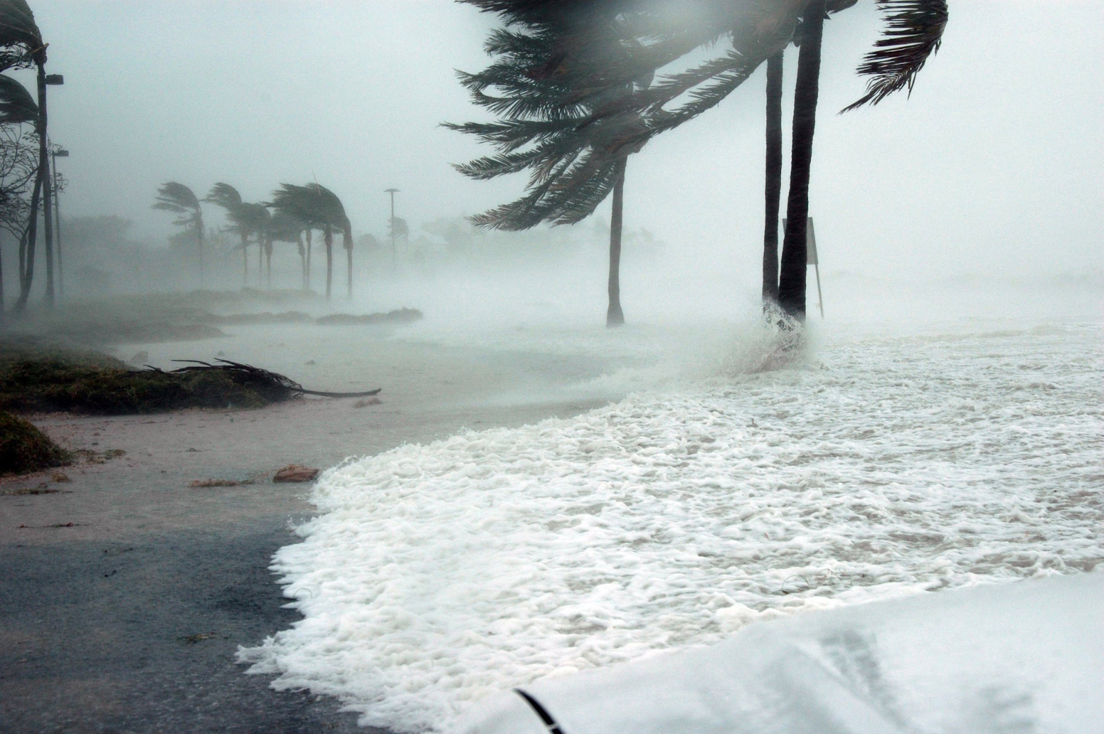
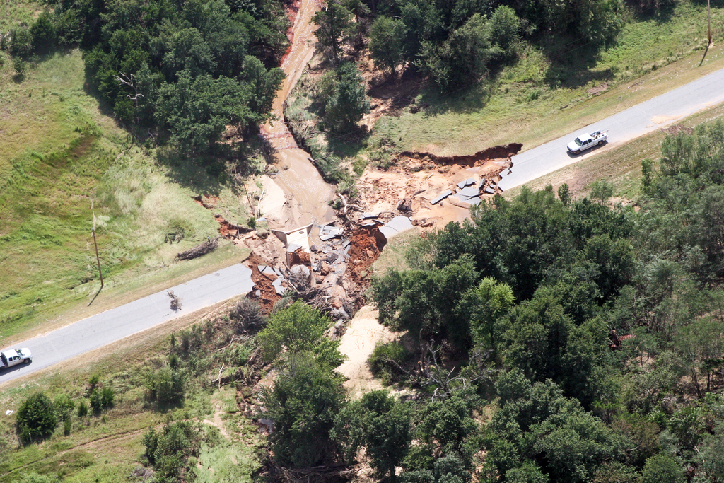
Storms like Erin are more than just a few days of extreme weather they ripple through communities for years. Human toll is the most obvious: loss of life, injury, and displacement. Economic impacts can be staggering like that of Hurricane Maria which caused over $90 billion in damage, and even less powerful storms can wipe out infrastructure and tourism income. Environmental costs are often overlooked: saltwater intrusion into farmland, destroyed coral reefs, and long term erosion that alters coastlines.

Even the anticipation of a storm can disrupt daily life, schools close, supply chains stall, and communities brace for evacuations. And for survivors like Karla, every tropical storm warning can reopen old wounds, triggering anxiety and sleepless nights.
Climate Context
Tropical Storm Erin is developing in waters that are, quite literally, record breaking. Sea surface temperatures in parts of the Atlantic are several degrees above normal, fueled by ongoing marine heatwaves NOAA. Warm water acts like jet fuel for storms, making them stronger, wetter, and faster to intensify. Combined with shifting atmospheric patterns, the result is a hurricane season that’s starting earlier, ending later, and packing more energy into each storm.
For the Caribbean, this means what happened to Karla in 2017 is no longer a “once in a lifetime” event. It’s becoming a recurring risk.

Looking Ahead
Meteorologists stress that storm forecasts can shift dramatically over just a few days. That’s why early preparation is critical: checking emergency kits, securing property, and following official updates from agencies like the National Hurricane Center.
For communities already marked by past storms, Erin is more than just another name on a list. It’s a reminder that resilience is an ongoing process, one that blends infrastructure, climate action, and the quiet strength of people like Karla Reyes Ríos, who continue to rebuild, again.
What Can You Do Now
- Review Your Hurricane Kit and make sure you have at least 3 days of water, non-perishable food, flashlights, a first aid kit, and necessary medications.
- Secure your home and property by trimming trees, bring in outdoor furniture, and reinforce windows or doors to prevent wind and debris damage.
- Stay informed with official updates by following the National Hurricane Center for forecast changes and local emergency alerts, not just social media rumors.
- Plan your evacuation route early by knowing the nearest shelter locations and map out multiple routes in case main roads are blocked NOAA Hurricane Safety Tips.